Unlocking the Power of Merging Drone and Ground-Level Imagery
Welcome to the world of aerial and ground-level photography, where technology has revolutionized the way we capture and interpret our surroundings. The seamless integration of drone and ground-level imagery has opened up a whole new realm of possibilities, offering unique perspectives and enhancing the way we view the world. In this comprehensive guide, we will explore the fascinating realm of combining drone and ground-level imagery, delving into the benefits, challenges, and future potential of this innovative approach.
The Evolution of Aerial Photography

In order to understand the significance of merging drone and ground-level imagery, it’s essential to first explore the evolution of aerial photography. Aerial photography dates back to the mid-19th century when photographers used balloons and early aircraft to capture bird’s-eye views of landscapes and cities. Over the years, advancements in technology have transformed the field, with the introduction of drones marking a major milestone in the history of aerial photography.
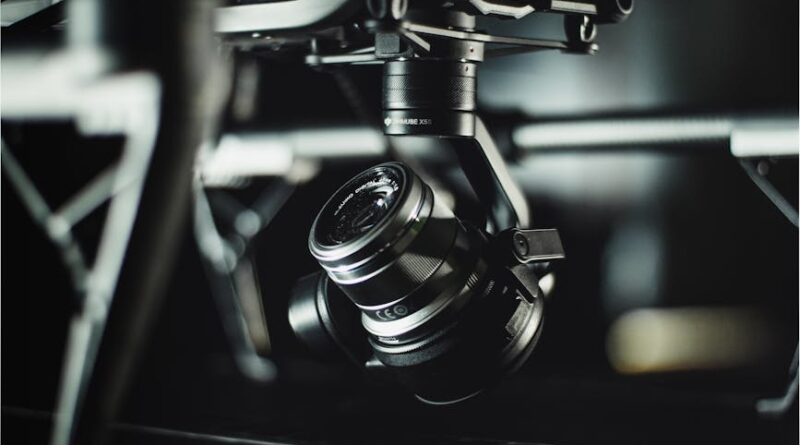
Drones, also known as unmanned aerial vehicles (UAVs), have revolutionized the way we capture images from above. These small, remote-controlled aircraft equipped with high-resolution cameras have made aerial photography more accessible, affordable, and versatile than ever before. By combining the capabilities of drones with ground-level imagery, photographers and professionals can now create comprehensive visual narratives that provide a holistic view of a given subject or location.
The Benefits of Merging Drone and Ground-Level Imagery

One of the key advantages of merging drone and ground-level imagery is the ability to capture a complete picture of a subject from multiple vantage points. By combining aerial views with ground-level perspectives, photographers can create compelling visual stories that offer viewers a comprehensive understanding of the scene. This approach is particularly valuable in industries such as real estate, construction, and environmental monitoring, where detailed and accurate visual data is essential.
Furthermore, merging drone and ground-level imagery allows for enhanced documentation and analysis of landscapes, infrastructure, and natural environments. By capturing images from different heights and angles, professionals can gain valuable insights into topography, vegetation, erosion patterns, and other environmental factors. This multi-dimensional view enables more informed decision-making and planning in various fields, from urban development to disaster response.
Applications in Various Industries

The integration of drone and ground-level imagery has opened up a wide range of applications across diverse industries. In real estate, for example, aerial photography is commonly used to showcase properties from a unique perspective, highlighting features such as location, size, and surroundings. By merging drone footage with ground-level images, real estate agents can offer potential buyers a comprehensive view of the property, enhancing marketing efforts and increasing sales.
In the construction industry, the use of drone and ground-level imagery is instrumental in monitoring project progress, inspecting infrastructure, and ensuring compliance with safety regulations. By capturing detailed images of construction sites from various angles, project managers and engineers can track developments, identify potential issues, and optimize workflows. This visual data not only improves efficiency but also enhances communication and collaboration among project stakeholders.
Challenges and Considerations

Despite the numerous benefits of merging drone and ground-level imagery, there are also challenges and considerations that professionals need to be aware of. One of the primary challenges is the complexity of integrating data from different sources and perspectives. Combining aerial footage with ground-level images requires sophisticated software tools and techniques to ensure seamless alignment and synchronization.
Another consideration is the regulatory framework governing the use of drones for aerial photography. In many countries, there are strict regulations concerning where and how drones can be flown, particularly in urban areas and near airports. Professionals working with drone and ground-level imagery must adhere to these regulations to ensure compliance and safety. Additionally, privacy concerns related to aerial photography should be taken into account, especially when capturing images in residential areas or sensitive locations.
Future Trends and Innovations
Looking ahead, the future of merging drone and ground-level imagery is filled with exciting possibilities and innovations. As technology continues to advance, we can expect to see improvements in the quality and resolution of aerial cameras, as well as the development of more sophisticated software for data processing and analysis. This will enable professionals to create even more detailed and accurate visual representations of the world around us.
Furthermore, the integration of artificial intelligence (AI) and machine learning algorithms into aerial photography workflows holds great promise for the field. By leveraging AI capabilities, professionals can automate the process of image analysis, object recognition, and data interpretation, allowing for faster and more efficient decision-making. This convergence of technology and creativity will continue to shape the future of aerial photography and its applications across various industries.
Common Misconceptions
One common misconception about merging drone and ground-level imagery is that it is solely a tool for capturing stunning aerial views for recreational purposes. While aerial photography certainly offers breathtaking perspectives of landscapes and landmarks, its applications extend far beyond mere visual appeal. Professionals in industries such as agriculture, environmental conservation, and urban planning rely on drone and ground-level imagery to gather vital data, monitor changes, and make informed decisions.
Conclusion: Elevating Perspectives, Enriching Insights
To wrap things up, the merging of drone and ground-level imagery represents a powerful tool for visual storytelling, data analysis, and decision-making across various sectors. By combining aerial views with ground-level perspectives, professionals can gain a deeper understanding of their surroundings, identify trends and patterns, and communicate complex information in a compelling way. As technology continues to evolve and innovations emerge, the possibilities for merging drone and ground-level imagery are endless, offering a new way to explore and interpret the world around us.
So, whether you’re a photographer, a researcher, or a professional in a specialized field, consider the unique insights and perspectives that merging drone and ground-level imagery can offer. Embrace the opportunities for creativity, innovation, and collaboration that this technology brings, and discover the endless possibilities of aerial and ground-level photography in the digital age.


